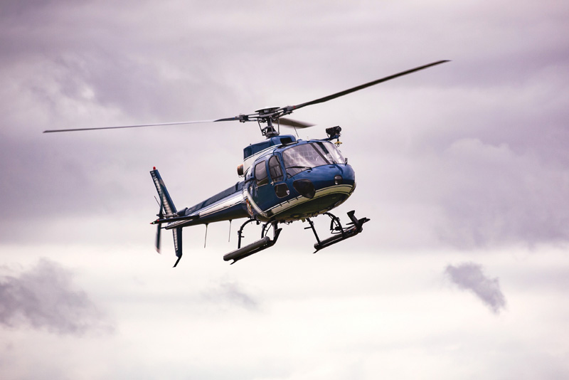
Firstlight Network will be using a helicopter to carry out pole top photography across our electricity network from early October through to December 2026.
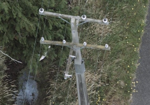
Pole top photography involves flying over the network and using GPS coordinates to take high resolution photos of overhead lines, poles and associated equipment.
The work will take around eight weeks to complete and plans to capture 34,000 poles.
“Pole top photography gives us a fast and effective way to assess the condition of the local electricity network, identify any defects, and monitor vegetation that may grow into lines.
“We understand people may have questions about privacy, however, please be assured that the photography will only capture our power lines and poles,” says Karen Frew, General Manager Electricity for Firstlight Network and Powerco.
Aethon Aerial Solutions will be carrying out the work on behalf of Firstlight Network.
The helicopters will strictly follow Civil Aviation Authority regulations and will fly above 300 metres in urban areas, and above 150 metres in rural areas.
In the event of bad weather, work will be rescheduled.
Low-flying helicopters can sometimes be unsettling, particularly for animals. To talk to one of the team about when the helicopter might be flying of your area, ring 0800 206 207.
We’ve also put together some questions and answers below.
Where we'll be flying
- Wairoa, Mahia, Frasertown and surrounding areas – 10 Oct to 18 Nov 2026
- Gisborne – including city and surrounding rural areas towards the west – 20 Oct to 25 Nov 2026
- Entire East Coast – including Tolaga Bay, Tokomaru Bay, Ruatoria and Te Araroa – 14 Nov to 5 Dec 2026
FAQs
When will the helicopter be flying?
The work is planned from approximately 1 October until 4 December 2026. Any changes to these dates will be updated on this page.
How low will the helicopter fly?
Per Civil Aviation Authority (CAA) requirements, the helicopter will only be flying in open air space. That means it will fly above 300 metres in urban areas, and above 150 metres in rural areas.
What are you photographing?
During the eight weeks, we aim to fly the entire 3,500km of our power lines, capturing 34,000 pole tops and the tops of 477 transmission towers.
Will you be taking photos of my property?
Your privacy will not be impacted by this work. We are only taking photos of our poles and crossarms, not residential properties. The photos are for internal asset assessment purposes only and are held in a secure location.
Here is an example of the type of photos taken:
Why don’t you use drones?
Drones can only last for a short period in the air before they need to be charged. It would require someone to travel with it on the ground across the network, which would be inefficient. A helicopter can run for several hours and cover much greater distance.
Who is carrying out the work for Firstlight Network?
Aethon Aerial Solutions will be carrying out the work on Firstlight Network’s behalf.
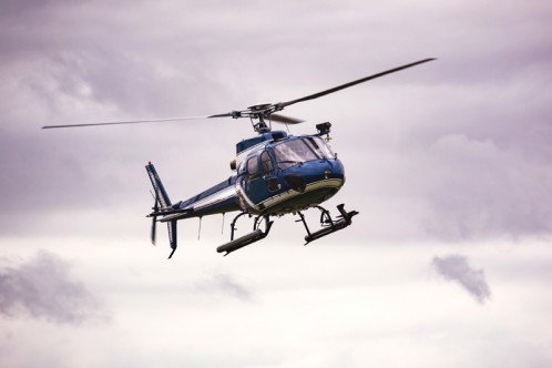
This is what the helicopter will look like:
Can you tell me when the helicopter will be flying near my property?
Depending on timing, we may be able to liaise with our flight crew so that people with animals can be given prior notice of when the helicopter is likely to fly over a specific area. Contact us on 0800 206 207 for more information.
In the event of bad weather, work will be rescheduled.
